
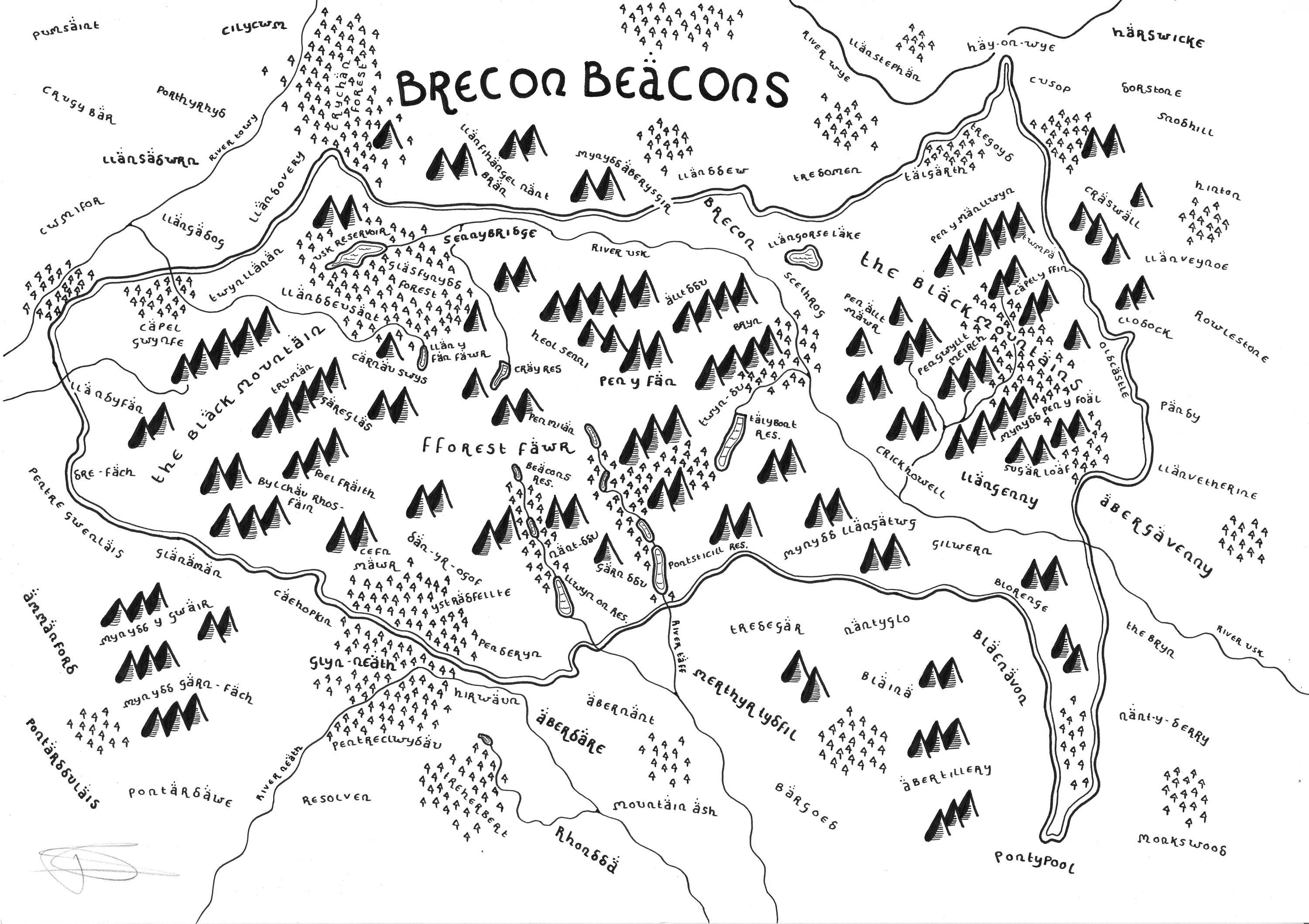
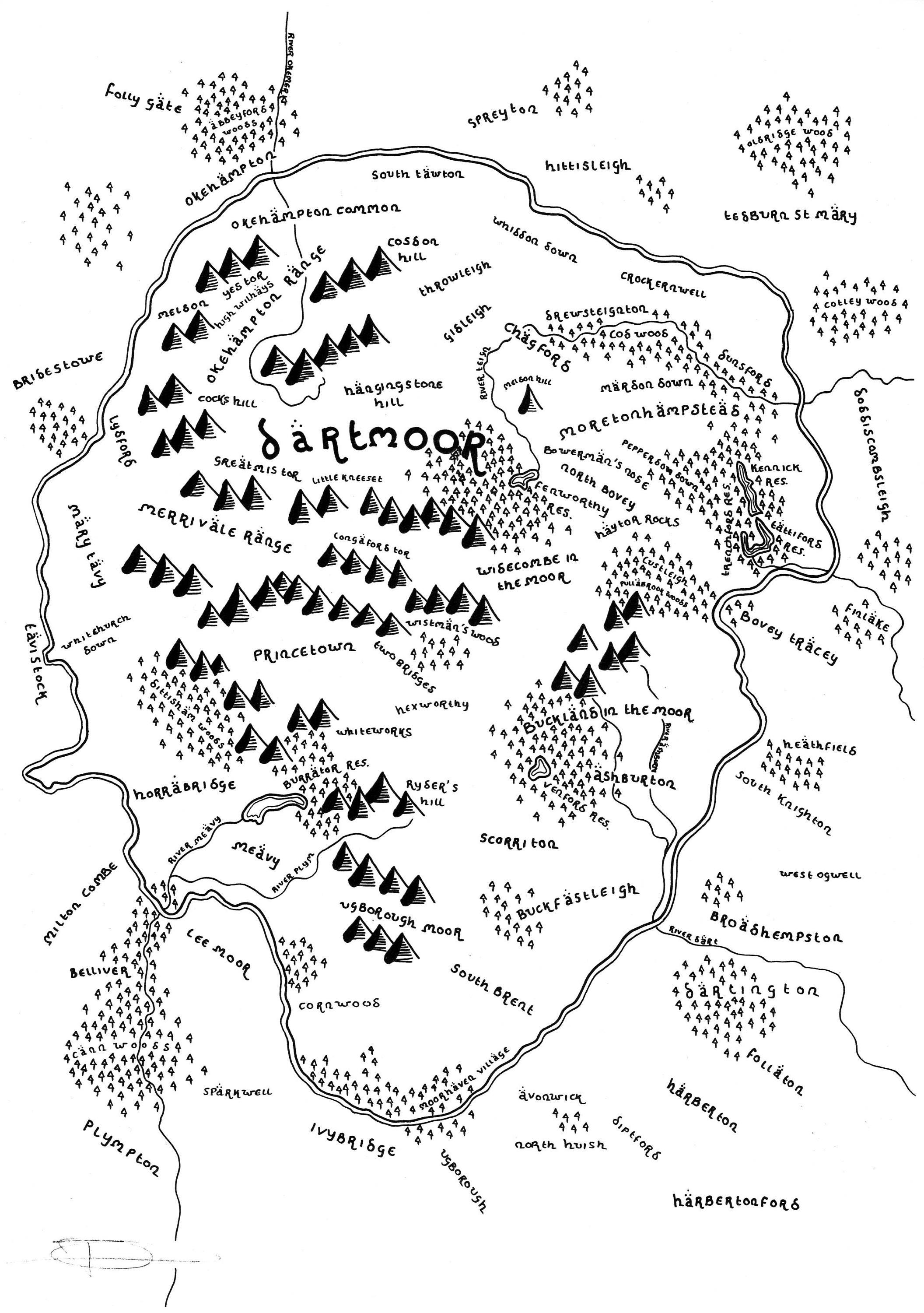
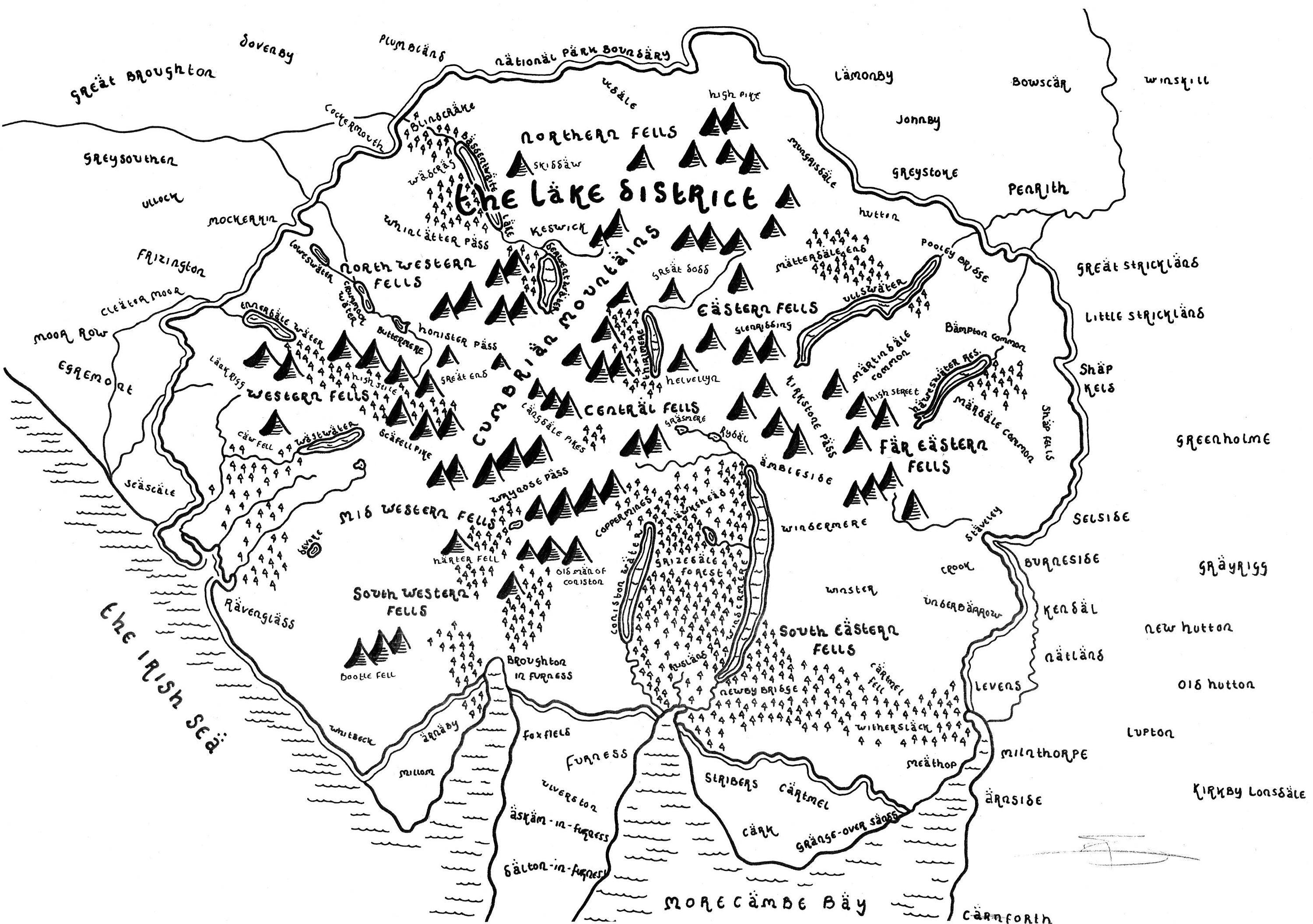
Amateur cartographer Dan Bell, 25, began his hobby of reimagining British national parks after recreating the Yorkshire Dales in the style of J. R. R. Tolkien.
Tolkien’s maps are recognisable for the font and sketch style of art which Dan has recreated perfectly.
“I like to think the maps allow people to imagine where they live in a Tolkien style.” he told the BBC.
He adds that the maps are “not drawn with accuracy in mind”, and are more an artist’s impression of each area.
He has currently drawn nine out of fifteen parks, including the Lake District, Dartmoor National Park, and the Brecon Beacons. Find his work, and to order your own, at his website.
Check out a few of his wonderful maps here:
March 16, 2023
Jurgis Bielinis and the Day of the Book Smugglers
Today marks a celebration of an event that many of you may not have heard…


April 24, 2021
Graham Norton to Launch Book Club Podcast with Audible
Some exciting news today as we hear that Graham Norton is launching his own book…

April 15, 2021
Artist draws Harry Potter scenes missing from the movies
An artist from Orlando, Florida has drawn scenes missing from the Harry Potter movie franchise,…